The Sea of Galilee: Geography, History, and Biblical Meaning
The Sea of Galilee: Geography, History, and Biblical Meaning
If you picture the Sea of Galilee as a large ocean, its name can be misleading. It is actually a freshwater lake in northern Israel, surrounded by hills, ancient settlements, and places closely associated with the ministry of Jesus. The lake is also called the Sea of Tiberias and Lake Kinneret, and all three names refer to the same body of water.
Its importance comes from several sources at once. The lake supports a distinctive ecosystem, forms part of the Jordan River system, preserves evidence of thousands of years of human settlement, and appears repeatedly in the New Testament. Understanding its geography helps explain why the region mattered to ancient communities and why the Gospel accounts describe fishing, sudden storms, and busy lakeside towns.
Where the Sea of Galilee is located and what it looks like
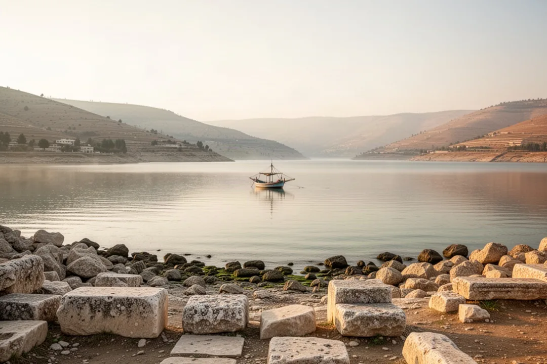
The Sea of Galilee lies in the Jordan Rift Valley, between the Galilee region to the west and the Golan Heights to the east. It is roughly 13 miles long from north to south and about 8 miles wide at its broadest point, although its shoreline and exact water level change over time. The lake sits approximately 209 meters below sea level, making it one of the lowest freshwater lakes on Earth.
The lake has a distinctive shape and is enclosed by steep or gently rising land on much of its shoreline. The northern basin is fed by the Jordan River, which flows south from the upper Jordan Valley. Several springs also contribute water, while the Jordan continues out of the lake at its southern end toward the Dead Sea.
Unlike an ocean, the Sea of Galilee is a freshwater lake. Ancient writers and biblical authors used the word “sea” for a large inland body of water, so the name reflects older language rather than saltwater geography. The lake’s freshwater has supported fishing, farming, and settlement for centuries.
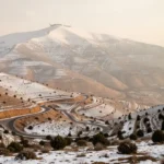
The surrounding landscape changes noticeably from shore to shore. The western side includes fertile areas and historic sites connected with Galilee. The eastern side rises toward the Golan Heights, with open slopes and volcanic terrain. In the north, the water narrows toward the Jordan River entrance, while the southern outlet continues the lake’s role in the regional water system.
Western shore: associated with towns and sites from the time of Jesus, including Capernaum and Magdala.
Eastern shore: marked by the uplands of the Golan region and several areas mentioned in Gospel narratives.
Northern end: connected to the upper Jordan River and fertile valleys.
Southern end: where the Jordan River leaves the lake and flows toward the Dead Sea.
The lake’s elevation and surrounding topography affect its weather. Warm air over the water can interact with cooler air descending from the hills, creating sudden wind and waves. These conditions help explain why experienced fishermen could still be caught in dangerous storms, even on a lake that is much smaller than an inland sea.
Useful distinction: “Sea of Galilee,” “Lake Kinneret,” and “Sea of Tiberias” are different names for the same freshwater lake. The term “sea” comes from ancient usage, not from the lake’s salinity.
Why the lake has several different names
The name Sea of Galilee connects the lake with the historical region of Galilee. Galilee was a significant area in northern Israel during the Second Temple period and the time of Jesus. The lake’s western and northern shores were part of a busy network of villages, roads, agricultural land, and fishing communities.
In the Hebrew Bible, the lake or nearby body of water appears under names such as the Sea of Chinnereth or Chinneroth. The name is associated with the Hebrew term Kinneret, which remains the common modern Hebrew name. Some explanations connect Kinneret with the shape of a harp, but the exact development of the name is not certain.
The name Sea of Tiberias comes from Tiberias, the city built on the western shore during the Roman period. Tiberias was founded in the first century CE and became an important urban center. The name appears in the New Testament, including passages that refer to the lake as the Sea of Tiberias.
Different names often reveal who was describing the lake and in what period. A biblical text may use a Hebrew or regional name, while a Roman-era writer may use a name connected with Tiberias. Modern visitors may hear Kinneret in everyday Israeli usage, Galilee in English-speaking religious and historical contexts, and Tiberias when discussing the city or the Roman period.
How the lake formed
The Sea of Galilee occupies a depression created by the movement of tectonic plates along the Great Rift Valley. This geological system extends through East Africa and the Middle East. Faulting lowered parts of the landscape, while volcanic activity and erosion shaped the surrounding basin over long periods.
The Golan Heights contain extensive volcanic formations, and basalt is visible in parts of the region. The combination of tectonic movement, volcanic rock, water, and erosion produced the landscape seen today. The lake is therefore not simply a shallow basin collecting local rain; it is part of a large and geologically active corridor.
Water levels naturally rise and fall according to rainfall, snowmelt, river flow, evaporation, and water use. Prolonged dry periods can lower the lake, while wetter years raise it. Because the lake supplies water and lies within a water-scarce region, its level has environmental, agricultural, and political significance.
Why the Sea of Galilee matters in the Bible
The Sea of Galilee is one of the most important geographic settings in the New Testament. Much of Jesus’ public ministry took place in Galilee, and many episodes occur on the lake or along its shoreline. The water was not a distant backdrop; it was part of everyday life for the people who lived and worked there.
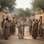
Several of Jesus’ disciples were fishermen, including Peter, Andrew, James, and John. The Gospel accounts describe Jesus calling fishermen, teaching from a boat, crossing the lake, and encountering people in lakeside towns. These stories reflect the lake’s role as a workplace, transportation route, and gathering place.
The Gospel of Mark 1:16–20 describes Jesus calling fishermen near the Sea of Galilee and inviting them to follow him. The passage emphasizes the ordinary setting of the call: nets, boats, family work, and a shoreline. In this context, the lake represents both the disciples’ livelihood and the point at which their lives changed direction.
Jesus also taught beside the water. In Mark 4, a crowd gathers near the lake while Jesus teaches from a boat because of the size of the crowd. The setting connects his teaching with familiar images from farming and fishing, including seed, soil, lamps, and nets.
One of the best-known episodes is the calming of a storm, recorded in Matthew 8:23–27, Mark 4:35–41, and Luke 8:22–25. The accounts describe Jesus and his disciples crossing the lake when a severe storm arises. Jesus rebukes the wind and waves, and the disciples respond with fear and amazement. The scene is especially vivid when read against the lake’s real weather patterns and steep surrounding hills.
Other important Gospel events associated with the lake include the feeding of the five thousand, the walking on the water, and a post-resurrection appearance involving a miraculous catch of fish. The references appear in different Gospel passages, and each account has its own emphasis. Together, they make the lake a central setting for teaching, conflict, revelation, and encounters with Jesus.
Calling of fishermen: Jesus calls disciples from their work along the lakeshore, as described in Matthew 4:18–22 and Mark 1:16–20.
Teaching from a boat: The scene in Mark 4 presents a practical response to a large crowd gathered at the water.
Storm on the lake: Matthew 8, Mark 4, and Luke 8 describe a crossing interrupted by dangerous weather.
Walking on the water: Matthew 14, Mark 6, and John 6 include accounts connected with the lake.
Breakfast by the shore: John 21 describes a resurrection appearance involving fishing and a meal near the water.
The lake also appears in the broader story of Jesus’ healing ministry. Towns and villages around its shoreline brought together people from different backgrounds, including Jewish communities and populations influenced by the wider Roman and Hellenistic world. The lake was therefore both local and connected to larger regional networks.
Which biblical towns and places surrounded the lake
Several ancient sites around the Sea of Galilee help readers place the Gospel narratives on a real map. Some locations are well established, while others remain debated because shorelines shifted, cities were rebuilt, and ancient descriptions can be difficult to match with modern terrain.
Capernaum and the northern shore
Capernaum stood on the northern shore and is closely associated with Jesus’ ministry. The Gospel accounts portray it as a base for activity in Galilee. Jesus taught in its synagogue, healed people, and called or encountered several disciples in the surrounding area.
Archaeological remains at Capernaum include a later synagogue built over or near the location of an earlier structure and a domestic building traditionally associated with Peter. The exact relationship between surviving structures and the first-century town requires careful interpretation, but the site clearly preserves evidence of a substantial Jewish settlement.
Capernaum’s location also makes sense economically. It was near the northern end of the lake, close to roads and productive fishing grounds. A settlement there could benefit from fishing, agriculture, transport, and trade.
Magdala and the western shore
Magdala, known in Greek as Taricheae, was located on the western side of the lake. It was associated with fishing and fish processing, and its name is linked with the local economy. The town is also connected in Christian tradition with Mary Magdalene.
Archaeological work at Magdala has revealed streets, domestic areas, ritual baths, a marketplace or commercial spaces, and a first-century synagogue. A carved stone found in the synagogue area has drawn particular attention because of its imagery and its connection to Jewish religious life during the Second Temple period.
Magdala demonstrates that the lakeshore was not made up only of small fishing villages. It included communities with organized public spaces, religious buildings, industries, and connections to wider economic networks.
Tiberias and the Roman period
Tiberias was founded by Herod Antipas and named for the Roman emperor Tiberius. Its establishment changed the political and urban character of the lake’s western shore. The city became a major center, especially in later Jewish history.
Because Tiberias was a Roman-era city, its relationship with Jewish religious and cultural life was complex. Its name eventually became one of the principal names for the lake. Today, Tiberias remains an important urban center and a common base for people visiting the region.
Bethsaida and changing shorelines
Bethsaida is mentioned in the Gospels as the home of several disciples. Its exact location has been debated, with archaeological candidates north or northeast of the present shoreline. Changes in the lake’s water level and the growth of deltas can affect how ancient sites relate to the water described in historical sources.
This uncertainty is a useful reminder that biblical geography is not always a matter of matching a modern sign to a verse. Archaeologists compare texts, architecture, pottery, coins, roads, topography, and settlement patterns. Some identifications are widely accepted, while others remain open to discussion.
Reading the Gospel stories geographically: The Sea of Galilee was a working landscape with boats, fishing gear, roads, markets, synagogues, farms, and crowded shorelines. Seeing those details helps place the biblical accounts in ordinary first-century life.
How fishing and daily life shaped the lakeshore
Fishing was central to the economy around the Sea of Galilee during the first century. The lake’s freshwater fish could be eaten locally, sold in markets, or preserved for transport. Fishing required boats, nets, repair work, storage, processing, and trade, so it supported more people than those who went out onto the water.
Ancient fishermen used different types of nets and worked from the shoreline or small boats. A successful catch could involve several people, which explains why the Gospel accounts sometimes mention partners, hired workers, family members, and boats. The work was physically demanding and depended on weather, seasonal conditions, and access to productive waters.
Villages along the shore also relied on agriculture. The surrounding region could produce grains, olives, grapes, dates, and other crops, depending on local soil and rainfall. Springs and fertile areas supported settlement, while the lake provided water and transportation.
Boats made it possible to move between communities more directly than traveling around the shoreline. A crossing could shorten a journey, but the lake’s winds made travel unpredictable. The same water that connected towns could become hazardous within a short period.
Roman rule influenced taxation, construction, trade, and administration. Fishing communities operated within that political system, and the economic pressures of the period form part of the background to the Gospel narratives. References to nets, boats, tolls, crowds, and local rulers are easier to understand when the lake is viewed as a commercial region rather than an isolated rural setting.
Fish also appear in several Christian traditions connected with the lake. Visitors may encounter the name “Saint Peter’s fish,” commonly used for a local tilapia species or for a fish dish associated with the region. The name is a modern religious and tourism tradition rather than a precise identification of the fish mentioned in every biblical passage.
What visitors can see and how to experience the lake responsibly
People visit the Sea of Galilee for religious pilgrimage, archaeology, scenery, swimming, boating, and regional history. A useful visit combines more than one viewpoint: spend time at the water, explore at least one archaeological site, and look across the lake from the surrounding hills. The landscape makes more sense when you see both the shoreline and the terrain that encloses it.
Common places to visit include Tiberias, Capernaum, Magdala, the Mount of Beatitudes area, and sites on or near the northeastern shore. Access, hours, admission policies, and boating arrangements can change, so check current local information before planning a detailed itinerary.
For a meaningful visit, consider these practical habits:
Check the season and weather: Heat can be intense near the water, while sudden wind can affect boat trips and outdoor plans.
Wear suitable footwear: Archaeological sites may include uneven ground, stone paths, and exposed surfaces.
Allow time for quiet observation: The lake’s scale, hills, and changing light are easier to appreciate without rushing between stops.
Follow local swimming and boating rules: Conditions vary, and not every shoreline is intended for swimming.
Respect religious and archaeological sites: Dress appropriately where requested and do not touch, climb on, or remove ancient materials.
Use water thoughtfully: The lake is an essential regional resource, so avoid littering and follow conservation guidance.
Sunrise and late afternoon often provide softer light over the lake, but the best time depends on your purpose. Early hours may be more comfortable for walking, while guided archaeological visits can help explain remains that are difficult to interpret on your own.
Swimming conditions are not identical along the entire shore. Some areas have designated beaches and facilities, while others may have rocks, sudden drop-offs, boat traffic, or no lifeguard service. Treat the lake as a natural body of water rather than assuming every attractive stretch is safe for entering.
Boat trips can offer a helpful sense of distance and orientation. From the water, you can see how close some settlements are to one another and how quickly the hills rise behind the shore. Operators may provide different types of excursions, so confirm the route, duration, safety arrangements, and weather policy in advance.
The Sea of Galilee is also an environmental resource under pressure from changing rainfall, evaporation, water demand, shoreline development, and pollution risks. Conservation efforts seek to protect water quality, habitats, fish populations, and the landscape’s cultural heritage. Visitors contribute by staying on marked paths, carrying out trash, and choosing responsible operators.
For readers interested in the Bible, the lake is most rewarding when its religious significance is joined to its physical reality. It was a freshwater lake below sea level, surrounded by working communities and vulnerable to sudden storms. It was also a place where Jesus taught, called disciples, crossed with his followers, and met crowds along the shore. Those two perspectives—geographical and biblical—belong together.
Frequently asked questions
Is the Sea of Galilee actually a sea?
No. The Sea of Galilee is a freshwater lake. Ancient languages and biblical writers commonly used “sea” for a substantial inland body of water, which explains the traditional name. It is also known as Lake Kinneret and the Sea of Tiberias. The lake is part of the Jordan River system and drains south toward the Dead Sea.
Why is the Sea of Galilee important to Christians?
It was a major setting in the New Testament accounts of Jesus’ ministry. Several disciples were fishermen from its shores, and the Gospels describe Jesus teaching near the lake, calming a storm, walking on the water, feeding a crowd, and appearing to disciples after the resurrection. Several important towns, including Capernaum and Magdala, stood nearby.
Can people swim in the Sea of Galilee?
Swimming is possible in designated areas, but conditions vary by location. Some shorelines are rocky, exposed, or affected by boat traffic, and not every site has lifeguards or facilities. Check local signs and current guidance before entering the water. Heat, wind, changing water levels, and strong sunlight are also practical concerns for visitors.
What is the best way to visit the Sea of Galilee?
Combine a lakeside stop with archaeological and religious sites such as Capernaum, Magdala, or Tiberias. Allow time to view the lake from both the shore and higher ground, since the surrounding hills explain its geography. Wear sun protection, use suitable footwear, confirm site hours, and follow local rules for swimming, boating, and photography.






Leave a Reply