Galilee: History, geography, and biblical significance
Galilee: History, geography, and biblical significance
Galilee is the northern region where much of Jesus’ public ministry took place. Its hills, villages, farmland, and freshwater lake shaped the history, economy, and religious life of the area.
Galilee lies in the northern part of the historic land of Israel, between the Lebanon mountain region to the north and the Jezreel Valley to the south. Its western edge reaches toward the Mediterranean coast, while its eastern side approaches the Jordan Valley and the Golan Heights. The exact boundaries changed across different periods, so “Galilee” can mean a political district, a cultural region, or a broader geographic area.
The region is commonly divided into Upper Galilee and Lower Galilee. Upper Galilee is more mountainous, with higher ridges, wooded slopes, and narrow valleys. Lower Galilee has rounded hills and wider agricultural areas. The distinction is geographic rather than a simple north-versus-south line, and both areas contain important archaeological and religious sites.
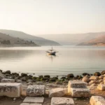
The Sea of Galilee, also called Lake Tiberias or the Sea of Kinneret, is the region’s most recognizable natural feature. Despite its traditional name, it is a freshwater lake rather than a sea. The Jordan River flows through it, and the lake sits below sea level in the deep Jordan Rift Valley.
A useful distinction: Biblical Galilee, modern northern Israel, and the wider area around the Sea of Galilee overlap, but they are not identical terms. Historical boundaries should be understood in the context of the period being discussed.
How Upper Galilee and Lower Galilee differ
Upper Galilee occupies the higher northern terrain. Mount Meron, the highest mountain in present-day Israel, is located in this area. The landscape includes steep valleys, limestone hills, springs, and forests. In antiquity, travel through Upper Galilee could be difficult, which helped preserve local communities and gave the region a distinct character.
Lower Galilee is lower and more open, though it is still hilly. Its valleys supported farming, vineyards, olive groves, and settlements. Nazareth, Cana, Sepphoris, and other places associated with the New Testament are located in or near this southern Galilean landscape. The region’s roads connected inland villages with the Sea of Galilee, the Jordan Valley, and major routes farther south.
The difference between the two areas matters when interpreting ancient travel accounts. A village in Lower Galilee might be relatively accessible from a larger town, while a settlement in Upper Galilee could be more isolated by ridges and ravines. Geography influenced local economies, communication, and the spread of religious ideas.
Why the Sea of Galilee mattered to ancient communities
The lake provided fresh water, fish, transportation, and fertile land. Fishing communities developed along its shores, especially where harbors and gently sloping beaches made boats easier to launch. Fish could be sold locally or preserved for trade, creating work for fishermen, boat builders, net makers, processors, and merchants.
The lake also connected communities. Boats could move people and goods across the water more directly than roads around the shoreline. At the same time, sudden winds and storms could make crossings dangerous. The surrounding hills influence air movement, so weather on the lake can change quickly even when nearby land seems calm.
Several ancient settlements stood near the shore, including Capernaum, Magdala, Bethsaida, and Tiberias. Their remains reveal a region with active trade, Jewish religious life, Roman administration, and changing urban centers. Archaeologists have found evidence such as houses, synagogues, bathhouses, fishing equipment, roads, and stone vessels.
The lake’s importance continued after the biblical period. Tiberias became a major city and later an important center of Jewish learning. Today, the shoreline combines religious destinations, archaeological parks, agricultural communities, nature areas, and tourist infrastructure.
Galilee in the Hebrew Bible and ancient Israel
The name Galilee appears in the Hebrew Bible, where it refers to a territory in the north. The phrase “Galilee of the nations,” associated with Isaiah 9, reflects the region’s position near international routes and its contact with neighboring peoples. The wording also suggests that Galilee was viewed as a borderland with a more diverse population than some areas farther south.
In the period of the Israelite kingdoms, northern territories were tied to tribes including Naphtali, Zebulun, and Asher. Those tribal descriptions belong to an ancient system of identity and land allocation, not to modern administrative borders. Later invasions, deportations, resettlement, and imperial rule changed the area’s population and political organization.
Galilee was affected by the expansion of the Assyrian Empire in the eighth century BCE. The region then passed through periods of influence or control under major powers, including the Babylonian, Persian, Hellenistic, and Roman empires. Each period left traces in settlement patterns, architecture, language, religious practice, and economic life.
The area’s location made it strategically significant. Routes linking Syria, the Mediterranean coast, the Jordan Valley, and inland regions passed near Galilee. Those connections brought trade and cultural exchange, but they also exposed local communities to military campaigns and political change.
Galilee during the time of Jesus
In the first century CE, Galilee was ruled by Herod Antipas, a son of Herod the Great. Antipas governed as a client ruler under Roman authority. He developed cities, collected taxes, and maintained political power while navigating the expectations of Rome and the traditions of the local population.
Jesus grew up in Nazareth, a small Galilean village, and the Gospels describe much of his teaching and healing activity in Galilee. His ministry is associated with places including Capernaum, the Sea of Galilee, Cana, and the surrounding villages. The Gospel accounts portray him traveling among both rural communities and larger settlements.
Galilee’s social setting helps explain why these accounts often mention farming, fishing, household work, debt, land, vineyards, sheep, and village relationships. These were not abstract images for the people who heard such teaching. They were part of daily economic and social life.
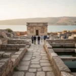
Capernaum is especially prominent in the Gospel narratives. It was a settlement on the northwestern shore of the lake and is associated with the home of Simon Peter, teaching in a synagogue, and several healing accounts. The archaeological site includes foundations of houses, a synagogue built in a later period, and remains connected with the ancient village.
Other places carry different kinds of significance. Cana is traditionally associated with the wedding at which Jesus turns water into wine in John 2. Magdala, on the western shore, was a substantial Jewish settlement connected by tradition with Mary Magdalene. Bethsaida is associated with several disciples and Gospel episodes, although the precise identification of the ancient site has been debated.
“The people living in darkness have seen a great light” is the theme Isaiah 9 applies to the northern region; Matthew 4 connects that imagery with Jesus’ activity in Galilee.
What Nazareth reveals about Galilean life
Nazareth is best understood as a modest rural settlement rather than a major city in the early first century. Its residents likely relied on agriculture, local crafts, and work connected with nearby towns. The village’s small scale makes the later prominence of Jesus’ association with it especially striking within the Gospel narratives.
The surrounding region was not cut off from the wider world. Sepphoris, only a short distance from Nazareth, became an important administrative and cultural center during the lifetime of Jesus. Its theaters, public buildings, roads, and mosaics show the influence of Hellenistic and Roman urban culture.
Scholars differ over how directly Jesus interacted with Sepphoris and how much its urban development affected Nazareth. The evidence does support a picture of Galilee as a place where Jewish traditions and Greco-Roman political culture existed side by side, sometimes uneasily.
Jewish communities, Roman rule, and local identity
Galilee’s population in the first century was predominantly Jewish, with Jewish religious practices, villages, agricultural life, and synagogue communities shaping the region. Roman rule did not erase local identity. Instead, it added taxation, military power, administrative systems, and urban projects to an already established society.
Some Galileans worked within the political and economic structures created by Rome, while others resisted them. Taxation could create pressure on farmers and fishing communities, particularly when families depended on land or equipment they did not fully own. These tensions formed part of the wider background to Jewish unrest in the first century.
After the First Jewish-Roman War from 66 to 73 CE, Galilee continued to be an important center of Jewish life. Later, after the destruction of the Jerusalem Temple and further political changes, Jewish scholars and religious institutions became increasingly influential in the region. Places such as Sepphoris and Tiberias played major roles in the development of rabbinic Judaism.
The Mishnah and later rabbinic writings preserve discussions associated with Galilean towns and scholars. These sources are religious and literary texts rather than simple travel guides, but they help show the importance of Galilee as a center of learning, law, agriculture, and communal life.
Major historical and religious sites in Galilee
Galilee contains sites associated with several faith traditions, as well as archaeological remains that illuminate ordinary life. A site’s religious importance may rest on scripture, later tradition, archaeology, or a combination of all three. Those categories should not be treated as interchangeable.
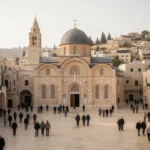
Nazareth: The town associated with Jesus’ upbringing, now a major Christian pilgrimage destination with churches, markets, and dense urban neighborhoods.
Capernaum: An archaeological site on the Sea of Galilee associated with Jesus’ ministry and the ancient fishing community that lived there.
Tabgha: A lakeside area traditionally connected with several Gospel events, including the multiplication of loaves and fish.
Mount of Beatitudes: A hill traditionally linked with Jesus’ teaching in Matthew 5–7, though the precise historical location cannot be proven with certainty.
Magdala: An ancient Jewish settlement with remains that include a first-century synagogue and other structures.
Sepphoris: A major ancient city known for public architecture, mosaics, and evidence of urban life in Roman-period Galilee.
Tiberias: A city founded in the early Roman period that later became a major center of Jewish scholarship and remains a modern lakeside city.
Safed: A hilltop city in Upper Galilee widely associated with Jewish mysticism, especially in the centuries after the medieval period.
Some locations are best visited for their archaeological evidence, while others are primarily places of worship. Churches, synagogues, mosques, cemeteries, national parks, and excavated ruins may have different rules and expectations. Visitors should consider the character of each site rather than treating every stop as an open-air museum.
How Galilee changed after the biblical period
Galilee remained a crossroads under Byzantine, Islamic, Crusader, Mamluk, Ottoman, and modern rule. Towns rose and declined, roads shifted, agricultural methods changed, and religious communities adapted to new political conditions. The built landscape therefore contains layers from many eras rather than a single continuous biblical scene.
Christian communities preserved and developed traditions connected with Jesus and the apostles. Jewish communities also remained central to Galilee’s identity, especially in towns such as Tiberias, Safed, and later other settlements. Muslim communities formed an important part of the region’s population and cultural history as well.
Safed became particularly important in the sixteenth century, when Jewish scholars and mystics gathered there after upheavals in the Mediterranean and Middle East. The city is strongly associated with the development and teaching of Kabbalistic traditions, although its history includes many other communities and periods.
In the modern period, Galilee includes Jewish, Muslim, Christian, Druze, and other communities. Northern Israel contains cities, villages, agricultural areas, forests, nature reserves, and contested or politically sensitive borders. Modern maps and travel conditions should be checked separately from descriptions of biblical geography.
Galilee’s landscape, agriculture, and wildlife
The region’s varied elevation creates noticeable differences in climate and vegetation. Upper Galilee tends to be cooler and more mountainous, while the areas around the lake can be warmer and more humid. Rainfall patterns, springs, and seasonal streams have long influenced where people farmed and built settlements.
Common agricultural products include olives, grapes, citrus, dates, vegetables, and other fruits, though the mix changes from one locality to another. Terraces on hillsides show how earlier farmers managed sloping land. Olive presses, wine installations, storage rooms, and agricultural tools found at archaeological sites provide evidence of long-term farming traditions.
Nature areas support birds migrating along the Great Rift Valley, as well as mammals, reptiles, and plant species adapted to Mediterranean and semi-arid conditions. The Hula Valley north of the Sea of Galilee is particularly well known for wetland and bird habitats. Water management and conservation remain significant concerns because the region’s natural resources are limited.
Outdoor experiences can include hiking, cycling, birdwatching, boating, and visiting springs. Conditions vary substantially by season. Summer heat can be intense near the lake, winter rain can make trails slippery, and spring weekends may be crowded at popular parks.
Practical tips and common mistakes when learning about or visiting Galilee
Galilee is easy to misunderstand if every traditional location is presented as certain or if modern borders are projected onto ancient history. A careful approach makes the region more meaningful and helps you plan realistically.
Separate tradition from proof: Phrases such as “traditionally identified with” signal that a site’s religious association may be ancient or meaningful without being archaeologically certain.
Check the period: A Roman-era synagogue, a Byzantine church, and a medieval Jewish quarter represent different histories, even when they stand in the same town.
Do not confuse the lake with the region: The Sea of Galilee is one geographic feature within Galilee, not another name for the entire area.
Allow for driving time: Mountain roads, traffic, security checkpoints, and crowded attractions can make short distances take longer than expected.
Wear suitable clothing: Modest clothing may be required at churches, synagogues, shrines, and other sacred places. Bring sturdy shoes for uneven archaeological ground.
Respect active religious spaces: Ask before photographing worshippers, services, religious objects, or private areas.
Use current local information: Opening hours, road access, trail conditions, and security guidance can change, especially near borders and protected areas.
Read the landscape: Notice water sources, terraces, harbors, hills, and valleys. They often explain why an ancient settlement developed where it did.
Planning tip: Group sites by area rather than trying to cross all of Galilee in one day. A Sea of Galilee route, a Nazareth and Lower Galilee route, and an Upper Galilee route each allow more time for the places you visit.
How to read the Gospels’ references to Galilee
When the Gospels mention Galilee, the reference may point to a broad region, a district, a town, or the lakeshore. The surrounding passage usually clarifies the meaning. A journey from Nazareth to Capernaum, for example, involves a different landscape and distance from a general statement about Galilee.
Matthew, Mark, Luke, and John emphasize different places and episodes. Matthew connects Jesus’ move to Capernaum with Isaiah’s imagery about light in the northern region. Mark frequently places teaching and healing around the lake. Luke gives attention to Nazareth and the wider mission in Galilean towns. John includes Cana, the lake area, and other settings while structuring its narrative differently.
Biblical place names can also appear in different forms because they pass through Hebrew, Aramaic, Greek, Latin, and modern languages. “Sea of Galilee,” “Sea of Tiberias,” and “Lake Kinneret” refer to the same body of water, but each name reflects a different linguistic or historical context.
Geography should support interpretation without replacing it. Knowing that villages depended on farming and fishing can clarify a parable or travel account, but it does not settle every question about authorship, chronology, or theology. Historical setting is one part of reading the texts responsibly.
When Galilee is the best place to focus your study
Galilee is especially useful for understanding the relationship between landscape and religious history. The region shows how water, roads, agriculture, political borders, and settlement patterns shaped the lives of communities described in the Bible and later Jewish and Christian writings.
It also helps correct a common picture of biblical history as centered only in Jerusalem. Jerusalem was crucial, but Galilee had its own villages, institutions, economies, debates, and traditions. The northern region was not a remote blank space; it was a populated and connected part of the ancient world.
Studying Galilee alongside archaeology, biblical geography, Jewish history, and modern local communities gives a fuller understanding than relying on a single pilgrimage tradition. The hills and lake still provide the physical setting, but the meaning of the region comes from the many people and periods that have shaped it.
Frequently asked questions
Is Galilee a country?
No. Galilee is a historical and geographic region, not an independent country. Most of the area commonly called Galilee is in northern Israel today. Its boundaries have changed over time, and historical references may include places that do not fit neatly within modern political borders.
What is Galilee best known for?
Galilee is best known as the setting for much of Jesus’ ministry, including places such as Nazareth, Capernaum, Cana, and the Sea of Galilee. It is also recognized for its Jewish history, Roman-era archaeology, mountain scenery, agricultural communities, and later importance in Jewish scholarship.
Are Upper Galilee and Lower Galilee separate countries or provinces?
No. They are geographic subdivisions of the broader Galilee region. Upper Galilee is generally more mountainous and lies farther north, while Lower Galilee has lower hills and wider valleys. The terms describe terrain and historical geography rather than independent political units.
Can you visit the biblical sites in Galilee today?
Yes, many sites are open to visitors, including Nazareth, Capernaum, Magdala, Sepphoris, Tiberias, and locations around the lake. Access, opening hours, trail conditions, dress expectations, and security conditions vary, so check current local guidance before traveling.






Leave a Reply